Chicago’s Conservation Legacy Expands: Uncovering and Safeguarding the Biodiversity of a 1.5 Million-Hectare Wilderness
Chicago and Guyanese scientists and Indigenous experts team up to document and protect one of Earth’s most ecologically-vital landscapes


In 2022, Walder Foundation made a series of five grants to advance Chicago’s contributions to tackling the global biodiversity crisis. These grants, now concluding, have generated vital progress in building conservation capacity in biodiversity hotspots. One of the grant recipients, Chicago’s Field Museum of Natural History (Field Museum), focused their work in Guyana. This work is featured below.
In November 2024, for the first time in nearly 90 years, a team of Indigenous experts, Guyanese scientists, and Chicago-based researchers embarked on a groundbreaking, month-long expedition to inventory the biodiversity of the ecologically rich and underexplored Acarai-Rupununi Corridor in Guyana. The ultimate goal of the survey was to gather baseline information and data to inform conservation decision-making.
A 97-person team, comprised of experts from the Field Museum, Guyana’s Environmental Protection Agency, Protected Areas Commission, and local institutions and communities, ultimately recorded*:
>600 plant species
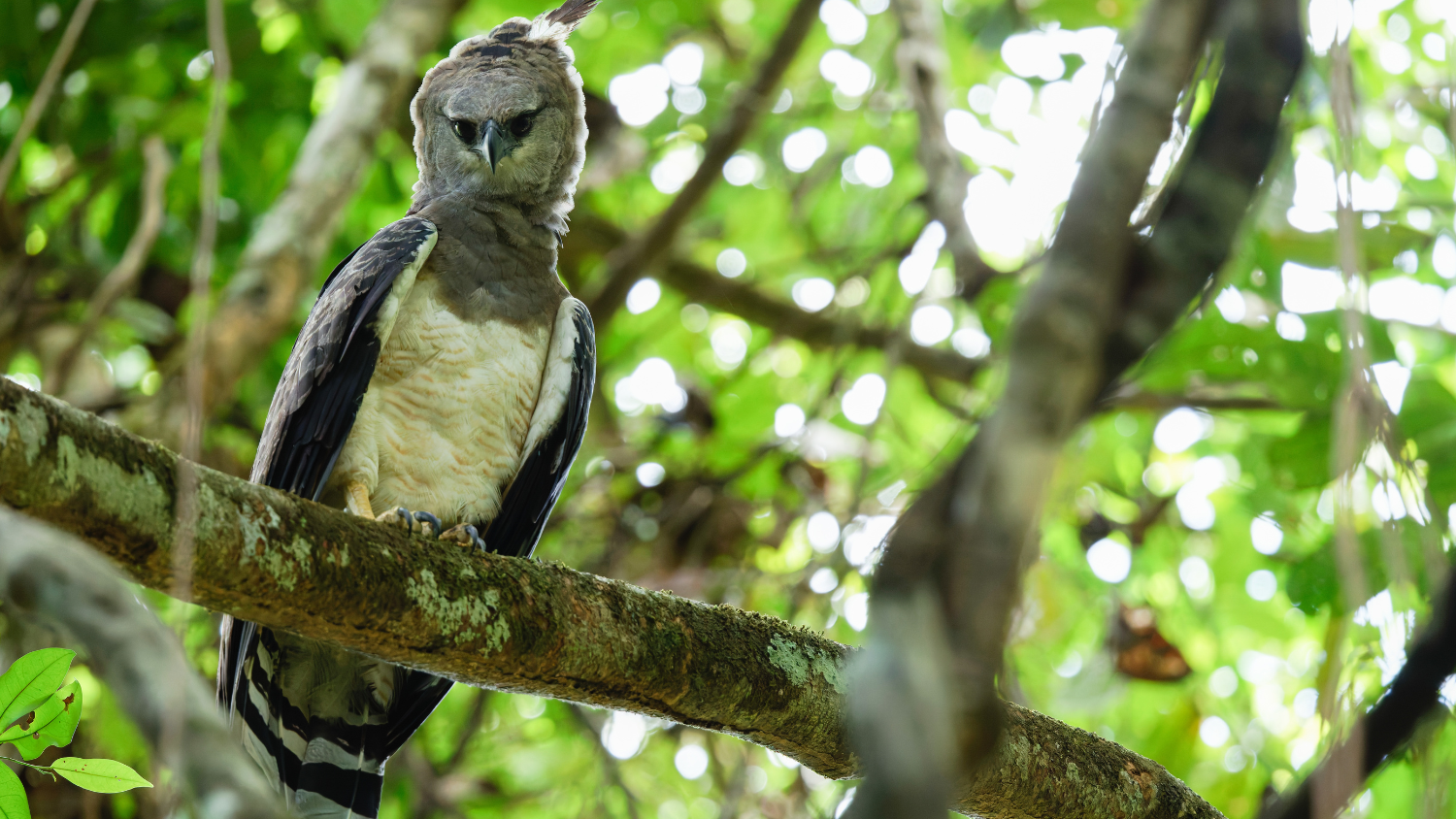
339 birds
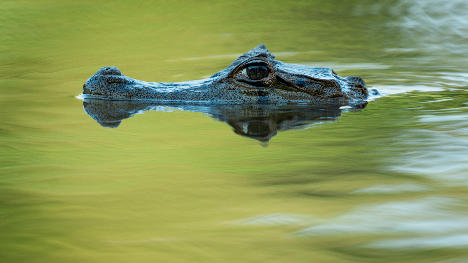
234 fishes
51 reptiles
47 amphibians
38 medium-large sized mammals
28 bats
17 small mammals


Of these overall totals, the inventory yielded:
35 species that are potentially new to science: 33 fishes, one lizard, and one frog
31 species that had never before recorded in Guyana: 22 fishes, five frogs, one bird, one lizard, and two trees
22 plant and animal species that are globally threatened: 10 mammals, six birds, four plants, and two turtles
Nine species endemic to Guyana: nine fishes
Unpacking and sharing the tremendous value of the biodiversity of the Corridor, enabled by this data and the people behind it, is a critical step in shaping country-wide and global conservation efforts.
Getting to Know Guyana Environmentally and Economically
The Acarai-Rupununi Corridor is a pristine, 1.5 million-hectare expanse, home to 800 million trees and trillions of individual organisms. It contains the headwaters of Guyana’s four largest rivers and generates over 11 billion cubic meters of freshwater annually.

Remarkably, the Corridor and Guyana at large have remained mostly intact — more than 90% of Guyana is still covered with untouched forest and savanna.
However, threats loom.
Guyana’s economy is quickly growing due in part to offshore mining. This mining means more construction across the country, with needs for hardwoods, minerals, and freshwater increasing daily.
At the same time, Guyanese have growing pride for their natural surroundings.
In response, the government is aiming for new forms of development — forms that can transform the country economically without destroying its nature.
Protecting the Acarai-Rupununi Corridor is part of that strategy.
“Twenty years ago, developers would have been competing to build roads into the Corridor to take advantage of its untapped old-growth forests and mineral deposits,” shares Lesley S. de Souza, Ph.D., a Guyana inventory expedition lead employed by the Field Museum. “Today, the government is building a plan to prevent just that kind of gold rush across more than 10 million acres of southern Guyana. Formalizing the conservation status of the Acarai-Rupununi Corridor, based on the Walder Foundation-funded rapid inventory, is the first step in that plan.”
Centering Indigenous Knowledge and Collaboration in the Inventory
At the heart of the inventory was the deep knowledge of the Waiwai, Wapishana, and Trio communities. These local experts identified species, interpreted seasonal patterns, and guided researchers through the landscape. Their contributions went far beyond data — they shaped the expedition’s philosophy and outcomes.
“We work with local Indigenous communities for so many reasons,” shared de Souza. “They know the forests and rivers of southern Guyana and the plants and animals that live there better than anyone else, and we would be lost without their insights. We also consider their input crucial for effective conservation. The reason is that conservation solutions are most successful and longest-lasting when they incorporate local people’s talents, strengths, and insights from the start.”
As a living testament to the wisdom of local residents, traditional fishing methods were used to yield nearly half of all fish specimens while petroglyphs and stone tool grooves showcased a needed history of habitation stretching back thousands of years.


Innovative Scientific Methods to Enhance and Expand the Inventory
For the past several years, Walder Foundation has been supporting the Field Museum's efforts to increase their capacity in modern biodiversity monitoring methods both in Illinois and around the word.
This rapid inventory effort was also significant because it was the first time the museum incorporated environmental DNA (eDNA) techniques into their surveys. This complemented other techniques previously used, such as acoustic monitoring.
This is a powerful supplement to traditional survey methods as it allows species to be recorded that evade observation or collection, due to their size, life histories, or sampling methods. The sampling technique enables collection of biological material shed by organisms (e.g. skin cells, hair, mucus) that has accumulated in the environment. Such materials contain DNA which can be collected and analyzed to determine the specific species present in an ecosystem.
In this study, eDNA methods identified 90 vertebrate species not found by any other method, demonstrating its effectiveness in providing a more complete picture of the region’s vast biodiversity.
Using Data, Convening Stakeholders, and Engaging the Public
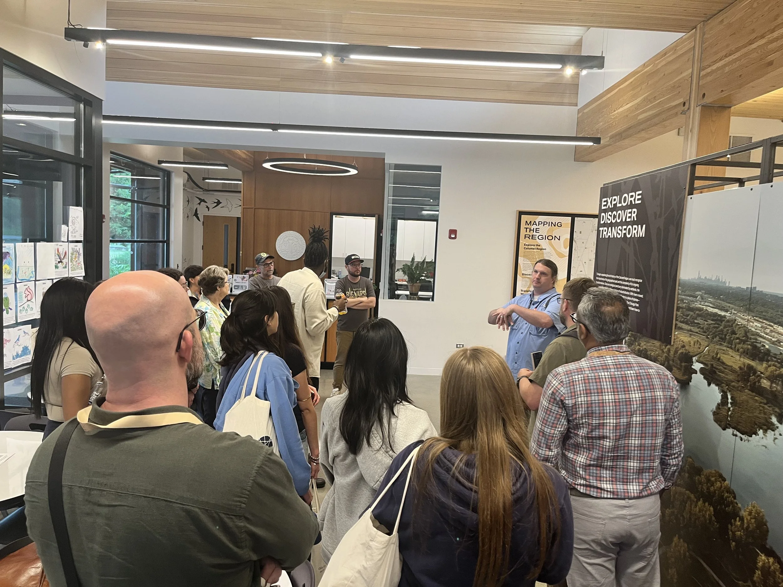
Just days after leaving the field, the team shared preliminary findings in a day-long workshop with 19 representatives of Guyanese government, academic, and non-governmental organizations and representatives from three Indigenous communities. During the workshop, participants focused on understanding assets, threats, and opportunities for conservation action in the Corridor. New data, alongside facilitated conversations and engagement, could help inform larger conservation-related decisions and would serve as the basis for post-inventory recommendations.
In February 2025, three Guyanese specialists helped process rapid inventory specimens and data at the Field Museum in Chicago. Results from the inventory were documented, and in July 2025, the report “RI32: Guyana: Acarai-Corentyne Corridor,”** was released to the public.
Recommendations for action, as outlined in the publication, included for Guyana to:
Establish legal protected status for the Corridor
Create a multi-stakeholder task force including Indigenous communities
Ban extractive activities like mining and dam construction
Ensure conservation benefits flow equitably to local residents and are communicated to the public
Support further research, monitoring, and cultural preservation
In the same month (July 2025), Guyana President Irfaan Ali positioned the country as a global leader in biodiversity conservation at the Global Biodiversity Alliance Summit, even referencing the new report.
There, President Ali reaffirmed Guyana’s science-informed pledge to double its protected areas by the end of the year and to meet the global “30 by 30” target — protecting 30% of land and marine ecosystems by 2030.
“Guyana’s biodiversity is not only surviving — it is thriving,” President Ali declared, as documented by Stabroek News. “We are home to vibrant, connected ecosystems where nature still functions at scale. This is no accident. It is the outcome of deliberate, sustained policies... and grounded in our national vision for sustainability.”
Since then, President Ali has invited the Field Museum to do another rapid inventory in southern Guyana. He and other governmental officials continue to use developed communications resources based on the 2024 inventory report, including an ArcGIS story map, video, posters, and infographics, at important regional and global conferences. The inventory will surely continue to be used moving forward to drive conservation ideas and priorities.
Watch a video (above) outlining Guyana rapid inventory findings and more information about Guyana’s Acarai-Rupununi Corridor.
Video courtesy of the Field Museum.
The discoveries made in Guyana are not just scientific milestones; they are a reminder of what remains to be protected and provide rationale for conservation action. That action can be supported right here in Chicago and around the world with dedicated resources, networks, and influence.
* Per “RI32: Guyana: Acarai-Corentyne Corridor,” these are preliminary numbers and may “increase as eDNA, audio data, and specimens are analyzed more fully.”
** “Acarai-Corentyne Corridor” was renamed “Acarai-Rupununi Corridor” after the July 2025 release of the report as informed by discussions with the government. The Field Museum’s report title continues to reference the area as the Acarai-Corentyne Corridor, but describes the newly-named Acarai-Rupununi Corridor.
Learn more about Walder Foundation's environmental sustainability work:
walderfoundation.org/environmental-sustainability.
Get more stories like this delivered to your inbox.
Sign up with your email address to receive news and updates.